Drone Topography and Site Mapping
Core serviceRTK drone mapping, orthomosaics, terrain models, contours, and repeat monitoring.
- Orthomosaic (GeoTIFF) and DSM/DTM
- Contours and linework (DXF)
- Point cloud (LAS/LAZ)
- Repeat-flight change comparison

Measure. Model. Manage. Move.
From the first flight to the next field decision. GPSCS connects aerial mapping, terrain, drainage, machine control, and subsurface evidence in one picture.
One site. Six ways to understand it.
A scan-style view of the LiDAR-derived USGS elevation model. These are terrain samples, not raw laser returns.
Public government terrain and imagery · vertical scale ×1.5. The drainage layer shows flow paths and ponding basins computed from this elevation model; rainfall, pipes, pumps and water depth are not modeled. Every underground layer shown here is simulated.
From air, to surface, to subsurface.
From the first flight to the file your crew uses in the field. GPSCS connects capture, analysis, subsurface evidence, and deliverables in one current site record.
01 / AERIAL CAPTURE
Capture the terrain. Establish a baseline. See what changes.
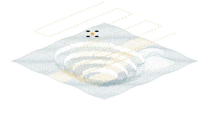
Orthomosaic · Point cloud · Elevation model
02 / TERRAIN ANALYSIS
Read the grades, track material, and understand where water goes.
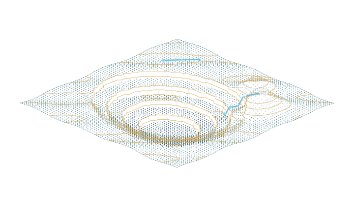
Volumes · Cut/fill maps · Drainage views
03 / FIELD SUPPORT
Connect the design, the site control, and the equipment using it.
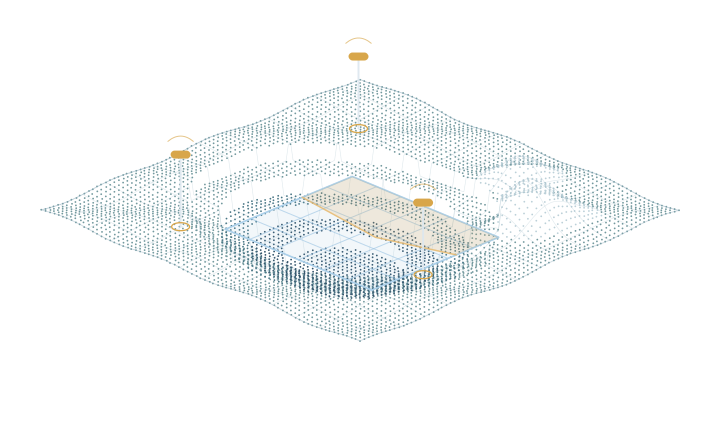
Machine files · Control checks · Field exports
04 / SUBSURFACE EVIDENCE
Connect observations to possible ground conditions and verification priorities.

Evidence layers · Probability views · Verification priorities
05 / DELIVERABLE CONTROL
Keep the current issue clear, with its review and release history attached.
Versioned files · Review status · Download history
Conceptual illustrations of the workflow.
One record. A clearer next step.The capture, the model, and the released file stay connected.
What we do
Every service produces deliverables that land in the same site record, so quantities, surfaces, and field files reference the same data and the same control.
RTK drone mapping, orthomosaics, terrain models, contours, and repeat monitoring.
Stockpile volumes, earthwork quantities, progress comparisons, and material movement.
Construction surfaces, grading models, machine-control files, field-ready exports, and custom modeling.
Trimble and GNSS equipment support, calibration assistance, field troubleshooting, and construction positioning support.
Flow paths, low spots, drainage concerns, slope review, and terrain-based planning.
Centralized site data, surfaces, volumes, deliverables, field files, approvals, and audit history.
Visualize underwater or water-adjacent conditions where applicable.
Organize and view borehole, core, and geological information in relation to the site.
Use site data and visual context to help identify potential field concerns.
Research direction
Beneath a site, the same measurement can support more than one geological explanation. GPSCS is designed to show those competing possibilities, combine them with borehole and field evidence, and communicate where uncertainty remains.
Illustrative research visualization. Not a certified geological reserve estimate or replacement for field verification.
The terrain is public data; the 720 m ERT line, logs and probabilities below it are simulated, and no drilling location is proposed.
Five steps, from measurement to a verification priority
Play the worked example, or explore the controls above.
Use Detailed section to hover or tap a cell. Both views use the same illustrative probability model.
ERT resistivity does not uniquely identify lithology by itself. Similar electrical signatures can correspond to different geological conditions, so the view keeps several candidate sections alive instead of drawing one.
Borehole logs, core observations, surface elevation, terrain geometry, and geological constraints enter as weights on the candidates. A candidate that contradicts a logged core loses weight; it is not silently deleted.
Translucent probability, competing interpretations, and hatched areas with insufficient coverage stay on screen. Where the system does not have enough information, the visualization says so.
Status. Subsurface decision support is an advanced research and prototype direction at GPSCS, shown here with public USGS surface elevation and USDA aerial imagery. LiDAR measures the surface; it does not reveal underground geology. The component reads a documented site-section schema so validated site data can be integrated later. Verification priorities are illustrative uncertainty scores, not validated drilling recommendations.
Surface: USGS 3DEP project CA_AZ_FEMA_R9_Lidar_2017_D18. The nominal 1 m LiDAR-derived DEM was resampled to approximately 4 m; the display mesh is simplified further. This is a terrain surface, not a raw point cloud. Vertical datum and measurement accuracy have not been independently verified for engineering use.
Imagery: USDA NAIP photography, May 14, 2022. Elevation and imagery come from different acquisition dates and may not match where quarrying changed the surface. Both datasets are U.S. Government public-domain data: USGS 3DEP elevation and USDA NAIP imagery from 2022. GPSCS did not collect either dataset.
Demonstration: An unnamed aggregate quarry in central California, shown using public government data. No customer relationship or operator endorsement is implied. The 720 m simulated ERT line is confined to a selected excavation window. The thin rubble cover, candidate materials, ERT-like values and logs are invented for teaching; they do not describe verified geology or propose drilling. Simulated layers are drawn at a depth below the present excavated surface, so they follow the benches rather than true geological horizons. The 3D volume extends a 2D scenario across an illustrative 160 m width; cross-line geology is unmeasured. The scan view renders DEM samples, not raw laser returns.
Drainage: Flow paths and ponding basins are computed by the GPSCS drainage engine from this public elevation model and shipped with the page; where that dataset is unavailable the page falls back to a simplified in-browser downhill routing. Either way the layer shows terrain routing only: rainfall, water depth, pipes and quarry pumping are not modeled.
USGS elevation source ↗ · USGS / USDA imagery source ↗ · Reproducible source details · Attribution
The GPSCS platform
A clear path from capture to release. Keep the model, the review, and the file your crew uses connected in one site record.
Flight data, surfaces, and design files in one place.
Check control, coordinates, and quality before release.
One approved Current Field File for each surface.
Retain release notes, logged downloads, and the audit trail.
 GPSCSSite workspace
Terrain, materials, and field evidence in context.
 Illustrative terrain
Probability layer: research illustration, not a verified ground model.
Read the site's shape from a different perspective.
Separate fictional terrain example with exaggerated vertical scale. This demonstration is not a GPSCS capture.
Sample quantities · 12 Sep 2026
| Stockpile | Material | Volume, m³ | Change, m³ | Relative volume |
|---|---|---|---|---|
| P1 North | ¾″ crushed | 4,230 | +310 | |
| P2 Yard | Screenings | 1,980 | −140 | |
| P3 West | Rip-rap | 6,120 | +1,050 |
Illustrative surface-to-base quantities, using a sample June 2026 base surface.
Sample net: 440 m³ cut, before any shrink or swell adjustment.
Current releases and earlier revisions, clearly separated.
A traceable record of reviews, releases, and field use.
Pad A design marked current after review by GPSCS QA.
PublishedRevision 7 validated. Awaiting client review before release.
In reviewSample flight: 412 images and 5 ground control points.
Pad A design, Revision B, downloaded by a field user.
Earlier issue retained. Superseded by Revision C on 12 September.
Make the approved issue easy to find. Keep earlier revisions clearly marked.
See what has been checked, who reviewed it, and what still needs attention.
Connect every download to the exact revision the crew received.
Who we work with
The same site record serves a single quarry and a multi-site operation. Pick your operation to see the problem we start with.
Site Intelligence Pilot
A pilot is scoped around a question you need answered: an inventory, an earthwork balance, a surface the machines can run. It ends with a decision, not a slide deck.
We define the site, the question, the deliverables, and the coordinate system and control you already use.
RTK drone flight with ground control, plus a GNSS check on your existing control where available.
Orthomosaic, terrain model, volumes or cut/fill, and any surfaces or files in scope.
Deliverables pass internal QA, then your review. Nothing is marked current until it is approved.
Approved files are released to the field. The dashboard shows what is current and who downloaded it.
You see the results against your question and decide whether to continue, expand to more sites, or stop.
GeoTIFF orthomosaics and elevation rasters, LAS/LAZ point clouds, DXF/DWG linework, LandXML surfaces, CSV quantities, PDF reports. Machine-control formats by request (Quote Required).
Delivered in your project coordinate system. Ground control, checkpoints, and residuals are documented with every mapping deliverable.
Client sites and figures are not published or reused as marketing material. Access is by named user and role, and downloads are logged.
Questions
No. GPSCS provides construction mapping, modeling, and site intelligence. Where a licensed land survey is legally required, it must come from a licensed surveyor. We work alongside licensed professionals and deliver in the control they establish.
No. It is a research and prototype direction that organizes measurements, borehole evidence, and competing interpretations into a probability view. Its purpose is to show what is known, what is uncertain, and where verification would help most. It is not a certified geological reserve estimate.
Site access, permission to fly, and any existing control or benchmarks you want the deliverables tied to. If you have none, we place and document ground control for the pilot.
Files are built to the format your system runs. Tell us what you operate when you request a quote; machine-control files are always Quote Required because they depend on the design, the machine, and the site.
Expedited service across the Southwest US, and anywhere in the continental US on demand. Multi-site and out-of-area work is scoped per request.
You do. Site data, deliverables, and figures are yours. GPSCS does not publish client sites or use them as marketing material.
Plan a Site Intelligence Pilot
We reply with a proposed scope: what to capture, what you receive, and what it costs for that site.